The Antelope Island Split Rock Loop Trail is a loop on Antelope Island in Davis County, Northern Utah. The trail has a fair amount of elevation change to it as it drops from the trailhead to near the water level and then climbs back up.
Trail Map
Total distance: 5.01 mi
Max elevation: 4894 ft
Min elevation: 4234 ft
Total climbing: 1104 ft
Total descent: -1114 ft
Max elevation: 4894 ft
Min elevation: 4234 ft
Total climbing: 1104 ft
Total descent: -1114 ft
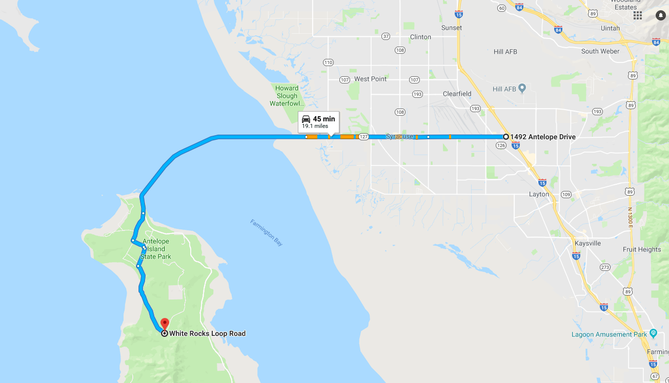
Directions to Trailhead
- From I-15 take the Layton Antelope Drive exit and turn west on Antelope Drive
- Drive west to the Causeway – there is a gate at the Causeway. Pay the fee to enter the island and then continue on the causeway to the island
- At the island stay left at the fork in the road
- Turn left at Buffalo Point Rd
- Turn right on White Rocks Loop Road
- Look for the trailhead when White Rocks Loop Road makes a sharp 90-degree turn at it’s south most point